Nestled high above the Chamonix valley, the Glacier de Bionnassay is a spectacular ice field that draws hikers, climbers and photographers alike. With its gleaming crevasses, deep blue ice patches and the dramatic backdrop of Mont Blanc, the glacier offers a view that feels both intimate and endless. Whether you are plotting a day‑long trail or a multi‑day hike, the region blends rugged mountain terrain with accessible routes from the tramway stations of Les Houches and Saint‑Gervais. In the following pages we’ll walk you through everything you need to know – from the easiest loop to the most demanding summit push – so you can plan a safe and unforgettable trek.
From the first crisp breaths near the refuge “Nid d’Aigle” to the final push across a glittering icefall at the glacier’s toe, the experience is shaped by elevation changes, weather patterns, and a keen respect for the fragile alpine environment. Let’s dive in, explore the routes, discover the best time of year, and uncover the hidden gems that make the Glacier de Bionnassay a must‑see destination for anyone travelling through Chamonix Vibes.
Table of Contents
Discovering the Bionnassay glacier
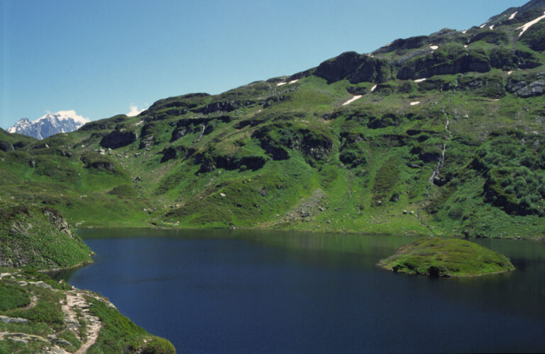
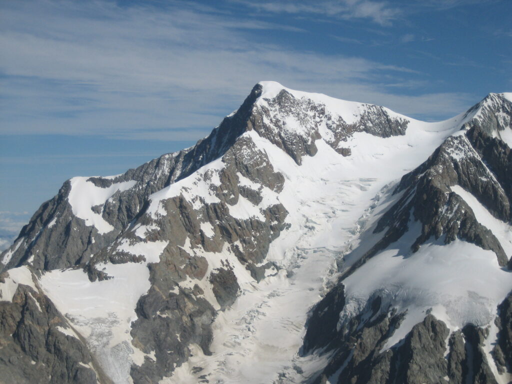
The bionnassay glacier stretches over 6 km², perched between 2 800 m and 3 500 m altitude. Its glacial tongue feeds several alpine lake basins, most famously the turquoise Lac des Chéserys, a perfect spot for a quick break. While the glacier itself is a perpetual ice body, it is constantly reshaped by the flow of ice, creating a landscape of seracs, moraines and occasional crevasses that require careful navigation.
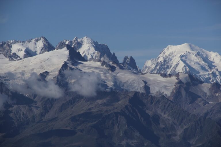
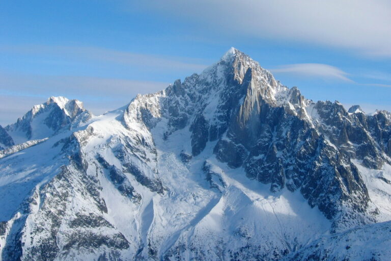
From a geological perspective, the glacier is part of the larger Mont Blanc massif, a complex of granite peaks and limestone ridges. The aiguille de Bionnassay – a sharp summit reaching 3 954 m – crowns the western side, while the iconic tête rousse stands to the north, offering striking silhouettes against the sky.
For those hunting a memorable view, the ridge that separates the glacier from the neighbouring mountain peaks opens up a 360° panorama of Mont Blanc, the Aiguille du Midi, and the distant peaks of the Pennine Alps. Photograph enthusiasts often wait for the “golden hour” in June or July when the low sun ignites the ice crystals, painting the valley below in shades of pink and orange.
Getting there: location and access points
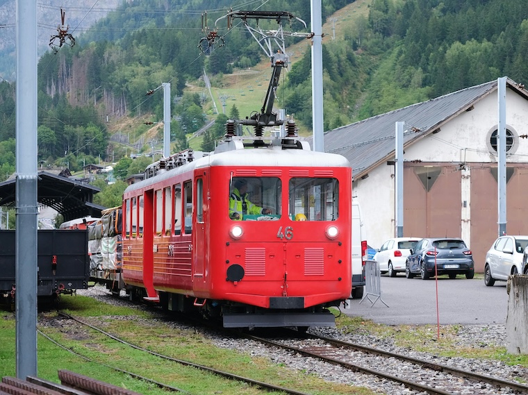
The glacier lies just north‑east of the historic town of Chamonix, reachable via the Montenvers tramway or the Les Houches railway line. The tramway from Saint‑Gervais‑les‑Bains ascends to Montenvers in under 20 minutes, dropping hikers at the foot of the Mer de Glace – a gateway to the bionnassay glacier via a well‑marked route. Alternatively, the Mont‑Blanc Express railway from Les Houches to Saint Gervais runs frequently and offers scenic vistas of the valley.
Both the tramway and railway operate daily from early April through early October, matching the main season for glacial travel. The last train departs Montenvers at 19:30, giving you ample daylight for an evening summit attempt if the weather permits. For those preferring to avoid the crowds, the early morning train from Les Houches (around 07:15) is a quiet alternative.
Parking is limited at the base stations, so we recommend using the public tramway or the railway whenever possible. If you drive, the route from Chamonix to Les Houches is well‑signposted, and a short distance of 6 km leads to the start of the main trailhead.
Trail options and difficulty levels
There are three main trail options that cater to different fitness levels and ambitions:
- Easy loop – a 9 km circuit that starts at the refuge “Nid d’Aigle”, passes the lake Lac des Chéserys and returns via the col de Veza. Ideal for families with children and well‑suited for dogs on a leash.
- Mid‑range hike – the classic “Royal Route” (also known as the GR 5) that traverses the glacier’s south rim, incorporating a moderate elevation gain of 800 m and a total distance of 14 km.
- Advanced summit push – a demanding ascent to the aiguille de Bionnassay via the east ridge, featuring technical climbing sections, exposure to seracs and a total altitude of 3 954 m.
Below is a quick comparison of the three routes:
| Route | Distance (km) | Elevation gain (m) | Difficulty |
|---|---|---|---|
| Easy loop – Nid d’Aigle to Lake | 9 | 400 | Easy |
| Royal Route (GR 5) – South ridge | 14 | 800 | Medium |
| Aiguille de Bionnassay ascent | 22 | 1 300 | Hard |
All three routes share a common segment: the first kilometre across the moraine leading up to the glacier’s upper edge. This stretch is marked with red and white cairns, and it offers the first glimpse of shimmering ice. Hikers should always carry a map of the Glacier de Bionnassay – the dominant reference is the official French IGN topographic sheet, which highlights crevasse zones, serac formations and the safest crossing points.
For seasoned alpinists, the ridge to the east of the aiguille de Bionnassay provides a classic climbing experience with sections rated AD (assez difficile). In contrast, the GR 5 segment is marked as T2 (moderate trail) and is suitable for fit hikers with a good head for altitude.
Weather, best season and safety tips
Alpine weather can change in an instant, especially around a glacier. The most reliable windows for a safe hike are June, July and early August, when snow melt has cleared most of the lower crevasses and the sun angle reduces the risk of icy patches. April can be tempting for early season photographers, but lingering snow and deep ice can make even the easy loop treacherous.
Typical weather patterns in July show daytime highs of 15‑20 °C at the base, dropping to 5 °C near the summit. Afternoon thunderstorms are not uncommon, so start early and aim to be back at the refuge before 14:00. The weather forecast can be checked via the local Meteo France App – it provides hourly updates for the col, the ridge and the lake area.
When crossing the glacier, always keep a rope handy, even on the easy loop; a simple 30 m alpine rope can save a life in case of a hidden crevasse. Furthermore, the French mountain rescue service recommends carrying a lightweight first‑aid kit, a headlamp, and enough water (at least 1.5 L per person).
Beyond the glacier – nearby attractions
While the Glacier de Bionnassay is the star attraction, the surrounding area offers several points of interest that enrich the day:
- Nid d’Aigle refuge – ideal for an overnight stay or a hearty meal.
- Les Houches – a charming village with a local market on Saturdays.
- Saint‑Gervais‑les‑Bains – famous for its thermal baths, great for muscle recovery after a hard climb.
For the more adventurous, the “Royal Route” links the glacier to the famous Mont Blanc summit trail, allowing a multi‑day trek across the iconic Alpine ridge system. It’s a classic crossing for those aiming to complete the full GR 5 long‑distance path.
Frequent Asked Questions
Is the glacier accessible for beginners?
Yes, the easy loop from the Nid d’Aigle refuge is suitable for beginners, families and even well‑behaved dogs. The trail is well‑marked, the elevation gain is modest (about 400 m), and the main hazards are limited to occasional small crevasses near the glacier’s edge.
Do I need a guide to attempt the aiguille de Bionnassay summit?
While a professional mountain guide is not legally required, the east ridge is classified as a steep climbing section (AD) with exposure to seracs and cornices. For safety, most alpine clubs recommend hiring a certified guide if you lack high‑altitude experience.
What is the best time of year to see the glacier’s icefall?
The icefall is most dramatic in late June and early July, when meltwater accentuates the flow of ice and the sun highlights the deep blue crevasses. After August, the icefall recedes as snow cover diminishes, reducing visibility.
Can I camp on the glacier?
Camping on the glacier itself is prohibited to protect the fragile environment. However, there are several alpine refuge options – such as the Nid d’Aigle – where you can spend the night in a sheltered setting.
Are there any hazards specific to the south ridge?
The south ridge can be windy and has a few exposed sections where the snow can be hard-packed, leading to slips. Early morning fog is also common in July, so a headlamp and compass are advisable.
How much water should I carry?
At altitude, dehydration sets in quickly. Aim for at least 1.5 L per person per day, more if the weather is warm or if you are undertaking the longer GR 5 segment.
Is the trail dog‑friendly all year?
Dogs are officially allowed on the easy loop from April to October, provided they stay on a leash. In the higher parts, leashes can become a safety risk near crevasses, so assess the situation carefully.
The alpine adventure awaits
From the pristine ice of the Glacier de Bionnassay to the lofty aiguille de Bionnassay summit, this part of the Mont Blanc massif offers something for every type of explorer. Remember to check the weather, respect the local regulations, and pack a solid set of essentials – a map, rope, and a positive attitude.
Whether you choose the leisurely loop, the classic GR 5 ridge, or the ambitious summit push, the rewarding view from the top – a horizon dotted with snow‑capped peaks and the shimmering glacier below – is a memory that will stay with you long after you descend back to Chamonix.
So lace up your boots, grab your trekking poles, and let the glacier guide you onto a new chapter of Alpine discovery. The mountains are calling, and the Glacier de Bionnassay is ready to welcome you.