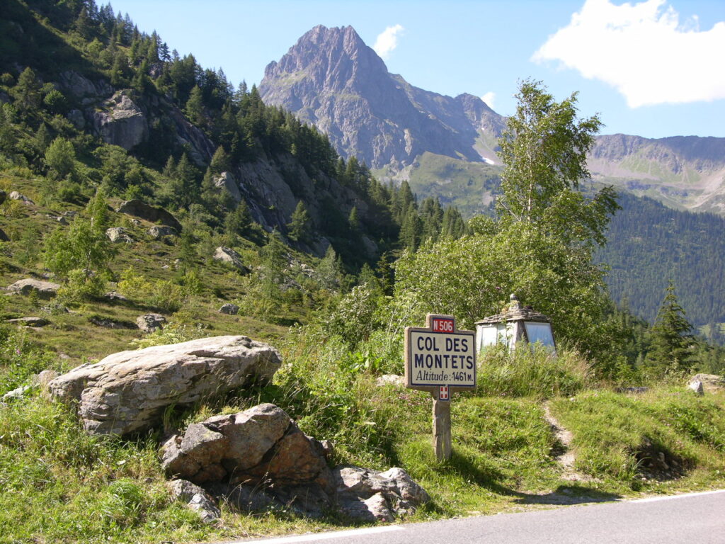
Rising to an elevation of 1 473 metres, the col des montets sits at the crossroads of French alpine tradition and Swiss border charm. From the moment you drive up the winding road that threads between the dramatic aiguilles rouges and the verdant vallorcine valley, you feel the pull of high‑altitude adventure. The pass opens onto a network of hiking trails that lead to the famed lac blanc, a mirror‑like basin perched above the chamonix valley, and to the iconic peaks of argentière. Whether you are planning a summer trek, a winter snowshoe, or a moderate running trail session, the Col des Montets offers a blend of breathtaking scenery, a touch of alpine history, and practical challenges that keep even seasoned mountaineers on their toes. In the sections that follow we’ll decode the access routes, the weather patterns, the difficulty grades and the little‑known regulations that shape a safe and unforgettable experience.
Table of Contents
Getting there: access, tunnels and traffic
The road to the col des montets is an engineering marvel that must be respected, especially during the brief but intense alpine winter. The primary artery is the D317, a narrow carriageway that threads through the tunnel des montets, an 1 km road tunnel built in the 1970s to shelter motorists from avalanches and rockfall. Inside, a speed limit of 30 km/h applies, and signage reminds drivers to carry snow chains or fitted winter tires when conditions deteriorate. Above the tunnel, the route climbs steadily, offering occasional parking bays near the summit – though space is limited, so early arrival is advisable, particularly in the high‑traffic summer months.
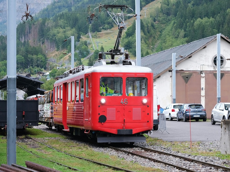
Parallel to the road lies the historic railway tunnel of Montroc, which serves the Mont Blanc Express and provides a scenic alternative for those who prefer to avoid the steep gradients. The rail line is subject to strict traffic controls during the peak ski season, and a speed limit of 20 km/h is enforced inside the tunnel to protect both passengers and wildlife that occasionally wander onto the tracks.
Drivers venturing from the Swiss side must be aware of different legal requirements. In the canton of valais and across the border into the swiss territory, the use of snow chains is mandatory when snow depth exceeds 5 cm, and the road is monitored for avalanche risk. The coordinates of the pass (45.9318 N, 6.8969 E) place it squarely within the french alps but within a stone’s throw of the alps that belong to the Swiss side.
The hike from Col des Montets to Lac Blanc
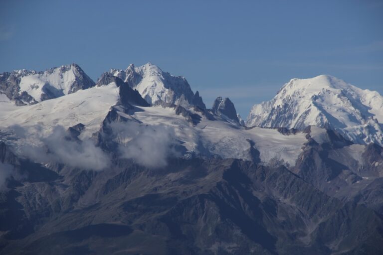
The classic ascent from the col des montets to lac blanc is a hard hike that rewards perseverance with an unforgettable panorama of the Mont Blanc massif. Starting at 1 473 m, the trail climbs roughly 600 m in elevation gain over 3.5 km, translating to an average gradient of about 17 %. The first section follows a well‑marked path through alpine meadows that double as a nature reserve, where wildlife such as chamois and marmots can be spotted at a respectful distance.
Half‑way up, the terrain shifts from grassy slopes to rocky scree, demanding surefootedness and a solid pair of boots. Here the difficulty spikes to very difficult for those unaccustomed to exposed ridgelines; the trail briefly joins a mountain pass that offers sweeping views of the aiguilles rouges and the distant argentière glacier. For the more adventurous, a short detour leads to a hidden bivouac spot that is occasionally used by climbers attempting the nearby col de la forclaz.
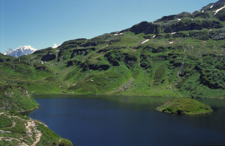
Reaching lac blanc itself feels like stepping into a painting. The lake, perched at 2 352 m, mirrors the rugged peaks surrounding it, its surface often still despite the occasional gust that rattles the surrounding boulders. The area is a designated nature reserve, and a prefectural decree expressly bans swimming in lac blanc and the adjoining lacs des chésérys, preserving the pristine water quality and protecting fragile alpine flora.
Running on the ridge
For trail runners, the route offers a moderate difficulty “run” that can be completed in under two hours if weather conditions cooperate. The key is to pace yourself on the flatter sections and respect the steep climbs where the ground is loose. Carrying a lightweight hydration pack is advisable, as the only water source near the summit is a small alpine spring that may be frozen in early spring.
When to go: weather, seasonality and snow conditions
Understanding the weather patterns of the col des montets area is essential for safe planning. Summer in the french alps is surprisingly mild; daytime temperatures hover around 15–20 °C, while night drops to near 5 °C. However, extreme weather can arise with sudden thunderstorms that bring heavy rain, hail, and a rapid rise in avalanche risk on the surrounding slopes.
Winter transforms the pass into a snow‑laden corridor where snow conditions vary from dry powder to dense crust. The tunnel des montets remains open year‑round, but the road outside may be closed for short periods after heavy snowfall or when a high‑risk avalanche warning is issued. In such cases, the railway tunnel becomes the preferred access, and ski patrols often provide real‑time updates on the pass’s status.
Spring offers a sweet spot: the snow melts enough to reveal the trail, yet the crowd levels remain low. This is the ideal window for those seeking a moderate difficulty hike without the summer tourist influx. Autumn, with its golden larch forests, is stunning, but early snowfalls can make the higher sections slippery, so proper traction devices are essential.
Seasonal checklist
- Summer (June–August): Sunscreen, layered clothing, rain jacket.
- Autumn (September–October): Warm layers, crampons for early snow.
- Winter (December–March): Snow chains, winter tires, avalanche beacon.
- Spring (April–May): Waterproof boots, trekking poles, spare gloves.
Practical tips: parking, dogs, gear and safety
Parking at the col des montets is limited to a small lot on the French side, clearly marked with a blue “P” sign. It fills up quickly during peak summer weekends, so arriving before 9 am is advisable. There is no dedicated dogs not allowed sign, but the area is part of a strict wildlife protection zone; dogs must be kept on a leash at all times, and many hikers prefer to leave their four‑legged companions at home to minimize disturbance to the local fauna.
Safety on the trail is largely a matter of preparation. The route’s difficulty escalates rapidly after the first kilometre, so a basic first‑aid kit, a map (preferably a topographic map of the Chamonix valley), and a fully charged phone are non‑negotiable. The trail is not marked for ski touring in winter, so if you intend to cross‑country ski, you must be proficient in avalanche assessment and carry an RECCO reflector.
One often‑overlooked hazard is the presence of the tunnel de montroc nearby, which has a steep approach and can collect snowdrifts. Drivers must obey the posted speed limit and be prepared for occasional traffic control points where officials check for proper equipment.
Gear highlights
| Item | Why it matters | Recommended brand |
|---|---|---|
| Sturdy trekking boots | Grip on scree and snow | La Sportiva |
| Lightweight waterproof jacket | Protection from sudden rain | Patagonia |
| Alpine trekking poles | Stability on steep sections | Leki |
Beyond Lac Blanc: connecting routes and the surrounding peaks
The lac blanc basin is not an isolated jewel; it serves as a hub for several other iconic alpine destinations. To the east, the rte de la forclaz leads hikers toward the col de la forclaz, a classic alpine pass that offers further views of the argentière glacier. Southward, a lesser‑known trail descends toward the lac de la persévérance, a serene spot ideal for a quiet picnic when the weather allows.
For those with a taste for technical climbing, the surrounding cliffs – especially the towering aiguilles rouges – provide world‑class bouldering routes. Local guidebooks list several classic problems, graded from 5a to 7c, that attract climbers from the nearby town of chamonix and beyond. The area’s reputation as a mountain pass for both hikers and climbers has fostered a culture of mutual respect and shared stewardship of the fragile alpine environment.
A short detour northward crosses the border into Valais, Switzerland, where the Swiss side of the Alps offers a panoramic view of the Alps that stretches into the horizon. The French‑Swiss border in this sector is marked by a subtle stone cairn, and the map of the region shows how the col des montets sits as a natural gateway between two beloved alpine nations.
“The moment you stand on the shore of Lac Blanc, looking back at the pass you just crossed, you realise that the journey is as spectacular as the destination.” – a frequent hiker’s note, 2025
Frequent Asked Questions
Is Chamonix in France or Switzerland?
Chamonix is a vibrant town located in the Haute‑Savoie region of France, right on the border with Switzerland and Italy. While it shares cultural and economic ties with its Swiss neighbours, administratively it belongs to France and serves as the gateway to the French side of the Mont Blanc massif.
What is the most beautiful hike in Chamonix?
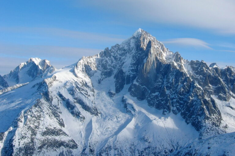
The trail from Col des Montets to Lac Blanc is often considered the crown jewel of Chamonix hikes. It combines dramatic elevation gain, crystal‑clear alpine lakes, and panoramic views of the Aiguilles de Chamonix and the Mont Blanc summit. Whether tackled in summer for its wildflower carpets or in winter for a snow‑covered tableau, it remains a must‑do for any mountain enthusiast.
Can I drive to the trailhead in winter?
Yes, but only if you equip your vehicle with snow chains or certified winter tires. The road through the tunnel des montets stays open most of the season, though occasional closures occur due to heavy snowfall or avalanche warnings. Checking the local traffic bulletins before departure is strongly recommended.
Are dogs allowed on the Lac Blanc route?
Dogs are not prohibited outright, but the area is part of a protected nature reserve. To minimise disturbance to the native wildlife, keep dogs leashed at all times and be prepared to turn back if the trail becomes too crowded or if weather conditions deteriorate rapidly.
What equipment is essential for a safe ascent?
A solid pair of waterproof trekking boots, a lightweight insulated jacket, and trekking poles are the basics. In winter, add avalanche safety gear (beacon, shovel, probe) and ensure your vehicle carries snow chains. A detailed topographic map and a GPS device will also help you stay oriented on the often‑steep sections.
Beyond the pass: why the Col des Montets deserves a slot on your itinerary
From the moment you roll into the col des montets parking area, you are greeted by a landscape that feels both wild and welcoming. The pass offers a perfect blend of accessibility – thanks to the well‑maintained road and tunnel – and adventure, with a trail that challenges even seasoned hikers while rewarding them with the iconic view of Lac Blanc. Its strategic location at the edge of the French‑Swiss border adds an extra layer of cultural intrigue, making it a natural springboard for further explorations into the Alps and the charming valleys of Vallorcine and Argentière. Whether you plan a summer trek, a crisp autumn run, or a snow‑swept winter ascent, the Col des Montets stands ready to deliver an unforgettable alpine experience.