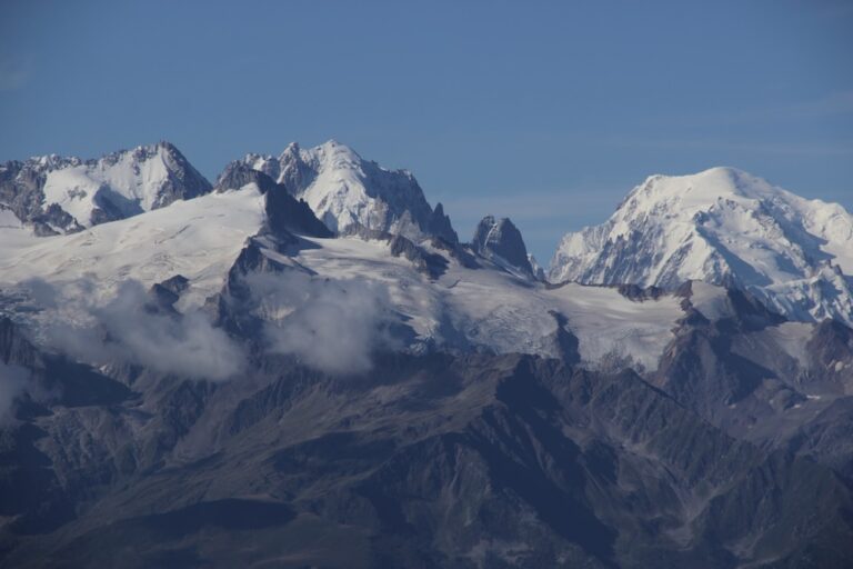
Perched at a strategic mountain location between Saint‑Gervais and Les Houches, the Col de Voza offers a panoramic view that frames the majestic Mont Blanc and the icy tip of the Glacier de Bionnassay. Whether you’re chasing a moderate hike, a hard trek, or simply a memorable loop trail, this high‑altitude pass blends forest serenity with alpine grandeur. The subtle scent of pine on the forest trail, the distant echo of a mountain shepherd’s bell, and the occasional bark of a hiker’s dog—welcome in this playground where pets are welcome—create a living tableau that feels both wild and inviting.
From the moment the tramway of the Tramway du Mont‑Blanc lifts you up to the start point, you’re greeted by a trail that weaves through lively mountain pastures, skirts the bright white of the Glacier de Bionnassay, and unfurls a sweeping mountain view that stretches across the French‑Italian‑Swiss borders. In the following sections we’ll unpack everything you need to know: trail conditions, elevation gain, dog‑friendly policies, and the best times to experience this unforgettable mountain pass. Let’s dive in.
Table of Contents
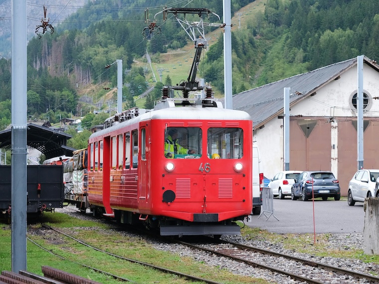
Getting there: the historic Tramway du Mont‑Blanc
The Tramway du Mont‑Blanc is more than a transport system; it’s a heritage ride that has shuttled adventurers since the early 20th century. Boarding at the Saint‑Gervais station, you ascend a gentle gradient that reveals a layered landscape of ancient rock, pristine snowfields, and, as the line approaches the Col de Voza, the iconic silhouette of Mont Blanc looming in the distance.
Although the tramway is accessible via ski lift during the summer months, it also doubles as a gateway for winter escapades. The ride takes roughly 25 minutes, and you’ll be disembarking at an altitude that feels like the edge of the world. Timing your tramway ride is crucial: aim for early morning departures to catch the soft golden light that bathes the surrounding peaks and to avoid the mid‑day crowds that tend to gather around the Bellevue viewpoint.
- Departure points: Saint‑Gervais, Les Houches, and Chamonix.
- Frequency: every 20‑30 minutes in high season.
- Last tram: 17:30 (subject to weather).
The trail outline: loop, elevation, and difficulty
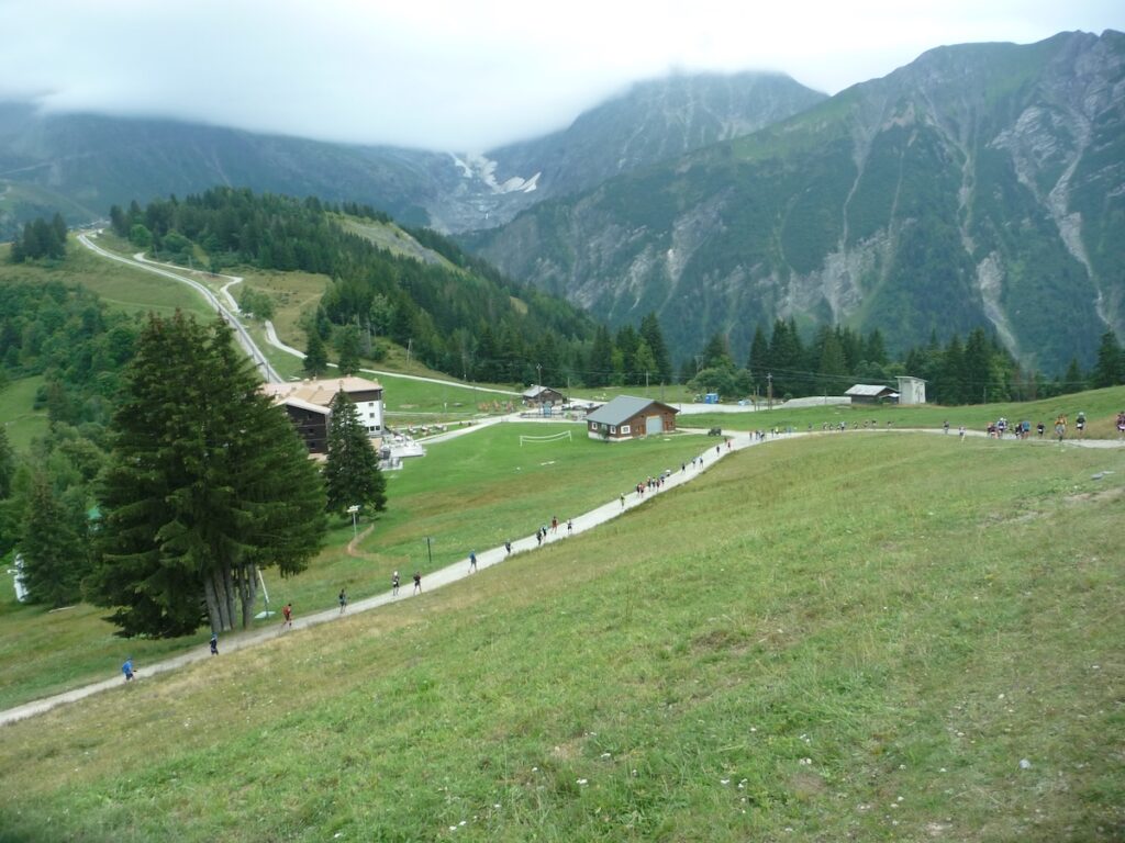
The Col de Voza circuit is a classic loop trail that can be completed in 4‑6 hours depending on pace and stops. Starting from the tram stop, the path climbs steadily, offering an elevation gain of about 700 m before reaching the col’s highest point at 2,330 m. From there, the route descends gently towards the village of Le Petit Chamonix, completing the loop with a mild downhill stretch that hugs a forest trail before reconnecting with the tramway station.
Hard hike or moderate trek?
Most guidebooks label the ascent as a moderate hike for seasoned walkers, while the full loop, with its occasional rocky scrambles near the Glacier de Bionnassay outlet, can feel like a hard hike for those new to altitude. The trail’s gradient averages 12 % on the steepest sections, but there are several switchbacks that ease the climb. If you’re comfortable with a solid cardio effort and have decent boots, the entire loop fits nicely into a day‑trip.
For ultra‑runners, the “Col de Voza Loop” is a popular training ground. Many local clubs organize early‑morning runs that start before dawn, aiming to capture the spectacular sunrise over the Mont Blanc massif.
Trail conditions and safety tips
Trail conditions vary with the season. In late spring, lingering snow patches can make sections slippery—crampons are advisable. Summer brings a well‑drained forest trail with occasional mud after heavy rain. Autumn offers colourful larch forests, yet the weather can turn quickly, so always check the weather forecast before heading out.
Key safety points:
| Aspect | Recommendation |
|---|---|
| Snow/ice | Carry micro‑spikes or crampons. |
| Rain | Pack waterproof trousers. |
| Altitude | Hydrate and pace yourself. |
Pets, dogs, and the wonderful wildlife
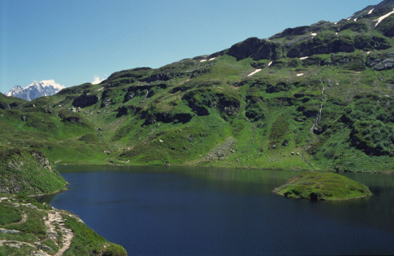
The Col de Voza trail is officially dogs allowed and pets welcome, provided they are kept on a leash. The area is a haven for alpine fauna: you may spot ibex grazing on the mountain pasture, golden eagles soaring overhead, and marmots chattering from rocky outcrops. Keep a respectful distance, especially during the rutting season of the chamois.
While most hikers bring their four‑legged companions, some choose to leave dogs at the base and opt for a solo trek. Either way, the route’s gentle slopes and scenic pull‑outs make it an excellent choice for families with pets.
Connecting to the Tour de Mont Blanc
If you’re tackling the famed Tour de Mont Blanc, the Col de Voza serves as a strategic checkpoint. After crossing the Bellevue plateau, trekkers often descend to the tramway station, catch the tram up to the col, and then re‑join the circuit near the Glacier de Bionnassay. This shortcut saves roughly 45 minutes of walking and offers a refreshing change of scenery.
Many guide operators include a short “Voza “detour” in their multi‑day itineraries, highlighting the panoramic view of the Mont Blanc dome and the chance to photograph the glacier in the golden hour.
Best times to hike and weather considerations
The optimal window for hiking the Col de Voza runs from late June to early October. During these months, the weather forecast usually predicts mild temperatures (10‑18 °C) and clear skies, granting spectacular panoramic views of the Mont Blanc silhouette and the surrounding peaks.
Early July may still hold residual snow on higher sections, while September brings the first hints of frost. Autumn colours are a photographer’s dream; however, the wind can pick up quickly, turning a serene hike into a brisk ascent.
- Peak season: July‑August – expect crowds near the tramway and the col.
- Shoulder season: June and September – quieter, but be prepared for variable conditions.
- Winter: Only for ski touring or snowshoeing with proper equipment.
Practical tips: planning your visit
Before you set out, a quick checklist can make the difference between a flawless day and a frustrating one.
What to pack
- Layered clothing: moisture‑wicking base, insulating mid‑layer, wind‑proof shell.
- Sturdy hiking boots with good ankle support.
- Map of the area or a reliable GPS device; the Col de Voza map is available at the tramway office.
- Plenty of water (2 L per person) and high‑energy snacks.
- Sun protection: hat, sunglasses, SPF 50+ cream.
How to read trail signs
Markings are typically white paint on rocks, supplemented by wooden cairns. Look for the “VOZA” abbreviation near the summit. The trail heads northward towards the Glacier de Bionnassay and southward back to the tramway.
Running and other activities
While the main traffic comprises hikers, the Col de Voza loop is also popular with trail runners. The mixed terrain—forest trail, alpine meadow, and occasional rocky scramble—offers a balanced workout. Just be mindful of slower walkers, especially near the mountain pass where the path narrows.
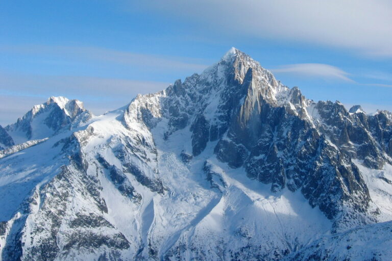
Capturing the majesty of Mont Blanc from the col
Photographers swear by the “golden hour” shot from the col’s western outlook, where the sun lights up the snow‑capped Mont Blanc and casts a pink hue over the Glacier de Bionnassay. For the ultimate panoramic view, position yourself on the small plateau just beyond the tram stop; the foreground of alpine flowers frames the distant peaks perfectly.
Don’t forget to experiment with a wide‑angle lens to encapsulate the full breadth of the valley—this captures the transition from rugged stone to gentle pasture, a visual story of altitude in a single frame.
Frequently Asked Questions
How high is Saint‑Gervais‑les‑Bains?
St Gervais spreads over an elevation range of 571 m to 4 810 m, encompassing several villages and the summit of Mont Blanc. The town itself sits at about 850 m, making it a convenient base for tramway rides to the Col de Voza.
What is the valley at the foot of Mont Blanc?
The Chamonix valley lies at the foot of the Mont Blanc massif. It stretches from east to west, linking resorts such as Servoz, Les Houches, Chamonix‑Mont‑Blanc, Argentière, and Vallorcine, and forms the natural corridor for the iconic Tour de Mont Blanc circuit.
What are the peaks around Mont Blanc?
Key summits include:
- Mont Blanc – 4 810 m
- Mont Maudit – 4 465 m
- Mont Blanc du Tacul – 4 248 m
- Grand Jorasses – 4 208 m
- Aiguille Verte – 4 122 m
- Aiguille de Bionnassay – 4 066 m
- Dent du Géant – 4 013 m
- Les Droites – 4 000 m
- Aiguille du Midi – 3 843 m
- Les Drus – 3 754 m
- Dômes Miage – 3 688 m
Are dogs truly allowed on the Col de Voza loop?
Yes, the trail is officially dogs allowed. Keep them on a leash, clean up after them, and be aware of occasional wildlife encounters.
Can I run the whole loop in under two hours?
Experienced trail runners can finish the loop in roughly 1 h 45 min, but this depends on fitness, weather, and how many photo stops you take. For most hikers, a comfortable pace is 4‑6 hours.
When is the best time for a panoramic view of Mont Blanc?
Early morning (around 7 am) during summer offers the clearest skies and the most striking light. Late afternoon can also deliver dramatic shadows across the glacier, especially in September.
Why the Col de Voza should be on every Alpine itinerary
From the historic charm of the Tramway du Mont‑Blanc to the rewarding mountain view that frames the iconic Mont Blanc, the Col de Voza encapsulates everything hikers love about the French Alps. Its moderate yet invigorating elevation gain, the flexibility of a loop trail, and the dog‑friendly policy make it an inclusive adventure for families, solo trekkers, and running enthusiasts alike. Moreover, its strategic position within the Tour de Mont Blanc network adds a practical shortcut for multi‑day explorers.
So, whether you’re chasing a sunrise over the glacier, seeking a quiet forest passage, or simply wanting to test your stamina on a hard hike, the Col de Voza stands ready. Pack your boots, check the forecast, and let the Alpine winds guide you to one of the most rewarding passes in the Chamonix valley.