Nestled at the crossroads of the Lac Blanc basin and the spectacular Lacs des Chéserys, the Plateau des Cheserys offers a rare combination of high‑altitude serenity and dramatic mountain scenery. From the first steps on the gravel trail you sense the crisp Alpine air, the distant echo of a glacier melt, and the daring silhouette of Mont Blanc against a sky that constantly shifts from pastel sunrise to deep indigo night. This guide walks you through every facet of the hike – access, difficulty, wildlife, and the unforgettable panoramic views that make this plateau a must‑see on any Chamonix adventure.
Reaching the plateau is a rewarding hike that threads through the mountain range of the Aiguilles Rouges and the glacial valleys that feed into the turquoise lake system of the region. Along the way, experienced hikers will encounter rugged rock outcrops, occasional waterfall cascades, and patches of colourful wildflowers that carpet the hillside in late summer. Though the route can feel difficult during early spring snow, the reward is immense: an expansive view of five distinct lakes reflecting the towering summits above, while the occasional sighting of an ibex or a herd of wildlife adds a touch of wilderness magic. Whether you are a seasoned photographer hunting the perfect mirrored sunrise, a trail runner seeking altitude, or simply a nature lover craving a quieter corner away from the crowd, the Plateau des Cheserys answers every call.
Table of Contents
Getting there: access, parking and essential route details
The journey begins at the parking area near the village of Les Houches, where a modest access fee grants you a short drive up the route leading to the trailhead. From here, the ascent follows a well‑marked path that quickly gains altitude, offering a gentle ascent before the terrain becomes more rugged. The total elevation gain is about 900 m, reaching an altitude of roughly 2,500 m at the plateau’s highest point. The duration of the round‑trip is typically 5–6 hours, depending on fitness and weather conditions.
- Parking: Limited spaces; arrive early in summer to avoid the crowded mornings.
- Access: Open daily from June to September; off‑season visits may require a permit.
- Transport: Local buses run from Chamonix to Les Houches (ticket required). Private cars are also welcome.
A handy map (see the table below) outlines the main waypoints, distances and typical weather conditions for each segment. Mountaineering gear such as microspikes and trekking poles are recommended once you pass the lower forested sections and enter the rocky terrain.
| Section | Distance | Typical weather (June‑Sept) |
|---|---|---|
| Lacs des Chéserys to Plateau des Cheserys | 1.8 km | Clear, excellent view of Mont Blanc |
Trail
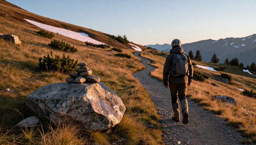
The first kilometre of the hike runs through a mixed forest of pine and larch, where the scent of pine needles mingles with the fresh water of trickling streams. Here, snowshoeing is still possible in early June, and the trail is occasionally dotted with cairns that guide the way. As you climb, the terrain shifts to a gravel and rock mix, with occasional ladders and steps installed to assist hikers over steep exposure sections.
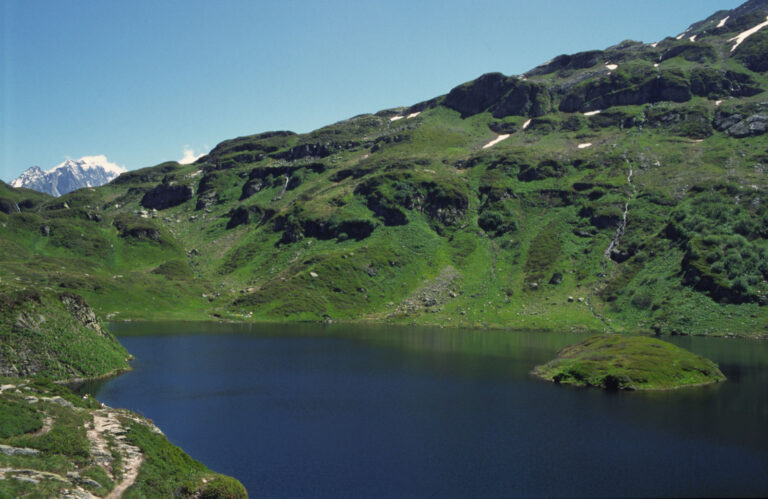
Mid‑way, you reach the Lacs des Chéserys – a series of serene lake basins that sparkle like mirrors. The largest of these, often called Lac des Chéserys, reflects the surrounding glaciers and the distant Aiguilles Rouges. Due to a prefectoral decree, swimming is prohibited to preserve water quality, but the reflective surface provides perfect photography opportunities, especially at sunrise when the water appears mirrored and the hills are painted gold.
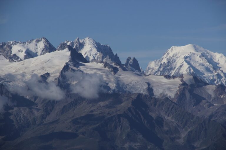
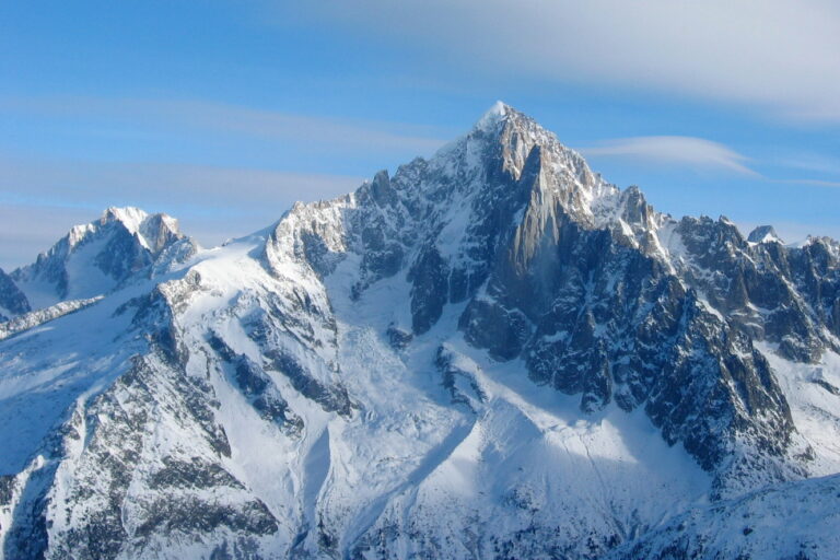
Beyond the lakes, the trail becomes a narrow ridge with occasional scramble sections across loose boulders and scree. The final ascent to the plateau involves a short but steep vertical push, where the path may feel exposed but offers an unrivalled panoramic sweep of the Mont Blanc massif, the Aiguille du Midi and the distant Glacier du Gèbre. The summit ridge is often marked by small cairns and a wooden sign noting the elevation.
Nature highlights: flora, fauna and Alpine geology
The plateau’s vegetation changes dramatically with altitude. Below 2,000 m, you’ll find wildflowers such as edelweiss, alpine poppies and gentians. As you climb higher, the flora gives way to hardy Alpine grasses and low‑lying shrubs that cling to the rocky terrain. In late summer, the area is peppered with patches of bright orange dandelion and delicate white carnation that contrast against the rock and snow patches that linger on shady slopes.
Wildlife is abundant but shy. Early morning hikers often spot ibex navigating the steep cliffs, while marmots whistle from the talus fields. Birdwatchers can enjoy sightings of the golden eagle soaring above the ridge, and occasional chamois may be seen grazing near the glaciers. The reserve status of the area helps protect these species, and visitors are reminded to keep dogs on a leash and respect the permit regulations to minimise disturbance.
The geology is equally fascinating. The plateau sits on a slab of ancient granite that has been sculpted by centuries of glacial erosion. Ice‑carved cirques and sharp ridges give way to smooth mirrored pond surfaces, while meltwater streams carve small waterfalls that feed the lakes. These features combine to create a constantly shifting landscape that photographers relish throughout the season.
Practical tips: safety, equipment and best times to visit
Safety first: Weather in the high Alps can change quickly. Always check the forecast before setting out and carry a small emergency rescue kit. In case of sudden storms, the nearest refuge – the Lac Blanc refuge – offers shelter, though it can be fully booked during peak season. Remember that the trail can become crowded on weekends, especially near the lakes.
- Gear: Layered clothing, waterproof jacket, sturdy boots with microspikes, trekking poles, and a headlamp if you plan a late return.
- Navigation: Carry a GPS device or a detailed IGN map; the trail is marked but occasional sections can be misleading after heavy snowfall.
- Water: Bring at least 1.5 liters; water can be collected from the clear mountain streams but should be filtered.
The best time to hike the Plateau des Cheserys is from late June to early September. Early summer offers lingering snow and potential snowshoeing experiences, while late summer provides the most reliable weather and the full bloom of wildflowers. Autumn brings vivid colour changes but also an increased risk of early snowfall. Winter ascents are possible only for experienced alpinists equipped for ice and avalanche risk.
Photography and artistic inspiration: capturing the mirrored magic
Photographers flock to the plateau for its mirrored lakes that perfectly reflect the surrounding mountains. The most spectacular shots are taken at the “golden hour” – just after sunrise or before sunset – when the light paints the glaciers and rock faces in warm hues. Using a polarising filter helps reduce glare and enhance the depth of the reflections.
For those interested in night photography, the plateau offers a clear view of the Milky Way, especially during the new moon periods. The lack of light pollution combined with the mirror‑like surface of Lac des Chéserys creates a stunning “nightglory” effect, where the stars seem to float above the water.
Remember to respect the environment: carry your trash back, stay on marked paths, and avoid disturbing the wildlife. Many local photographers recommend using a tripod with a small footprint to protect the fragile alpine soil.
Frequent Asked Questions
What is the difficulty level of the Plateau des Cheserys hike?
The route is classified as moderate to difficult. While the first part through the forest is gentle, the final ascent involves steep, exposed sections and occasional scrambling over rocks. Hikers should be comfortable with a vertical gain of about 900 m and have basic alpine experience.
Can I bring my dog on the trail?
Dogs are not allowed in the réserve des Aiguilles Rouges to prevent disturbances to the ibex and other alpine fauna.
Is swimming allowed in the Lacs des Chéserys?
No. A prefectoral decree bans swimming in both Lac Blanc and the Lacs des Chéserys to protect water quality and the delicate ecosystem. Visitors can, however, enjoy the reflective beauty from the shore.
Do I need a special permit for the trail?
A general access permit is included with the parking fee in summer. For winter ascents or group activities exceeding ten people, an additional permit from the local reserve authority may be required.
What gear is essential for winter visits?
During winter, bring crampons, an ice axe, insulated clothing, a reliable headlamp, and a full avalanche safety kit (probe, shovel, transceiver). Some sections become snow‑covered and can be traversed safely only with proper equipment.
Are there any mountain huts nearby for bivouacking?
Yes. The Lac Blanc refuge, situated at 2,352 m, offers simple dormitory accommodation. For a more rustic experience, designated bivouac spots are marked near the plateau edge, where hikers may set up a lightweight bivouac (check local regulations first).
How can I avoid the crowds on popular days?
Start early before 8 am on weekends, or choose a weekday in late August when the trail is less congested. Using the loop route that combines the plateau with the surrounding ridges also spreads out traffic.
Why the plateau should be on your bucket list
From the dazzling reflections of Lac Blanc and the Lacs des Chéserys to the rugged glacial ridges that frame the Mont Blanc massif, the Plateau des Cheserys offers a compact yet profound alpine experience. The hike blends physical challenge with artistic reward, wildlife encounters with geological wonder, and the quiet of a high‑altitude meadow with the drama of dramatic sky changes. Whether you’re a seasoned mountaineer, a casual hiker, or a photographer chasing that perfect mirrored sunrise, this plateau delivers an unforgettable adventure that embodies the soul of the Chamonix valley.
Plan your visit responsibly, respect the reserve guidelines, and let the panorama of snow‑capped peaks and crystal‑clear lakes inspire your next mountain story.