If you have ever dreamed of stepping onto a ridge where the Lac de Pormenaz mirrors the sky and the Pointe Noire de Pormenaz crowns the horizon, you are in the right place. Nestled between the villages of Servoz and Passy, the Tête de Pormenaz rises to an altitude of 2 152 m, offering a blend of alpine meadows, rocky arêtes and crystal‑clear water bodies that have made it a favorite spot for locals and adventurous tourists alike.
Reaching the summit is not a matter of taking a cable car; it is a genuine mountain experience that starts from the Parking des Moulins d’en Haut or from the historic Servoz – Ancienne Poste. Along the way you will cross the Gorges de la Diosaz, pass the traditional Chalets des Alpages de Pormenaz, and perhaps even spot a lone cairn marking the old shepherd routes. In the sections that follow we’ll unpack the best ways to enjoy this area, from easy family hikes to the most demanding summit pushes.
Table of Contents
Where is Tête de Pormenaz ?
The mountain sits in the heart of the Haute‑Savoie department, just a short drive from the Office de Tourisme of Chamonix. The most convenient access points are:
- Départ Servoz – a car‑friendly road that follows the Route de la Côte and leads to the parking area at the Moulins d’en Haut.
- Départ Plaine Joux – a steeper, more scenic trailhead that drops you nearer to the Arête de Pormenaz.
- A public bus stop near the commune of Chavanne‑Neuve, serviced by the local high‑mountain office.
All three start points are clearly marked on the Tête de pormenaz map available at the tourist office, and the AllTrails.com app gives a handy visual of the chemin network. The area is part of a Zone naturelle d’intérêt that protects the fragile alpine flora and the occasional ibex that roams the high pastures.
Hiking the Alpages de Pormenaz – routes, difficulty and highlights
The Randonnée aux Alpages de Pormenaz can be divided into three main routes, each suited to a different level of ambition:
1. The gentle loop – family‑friendly
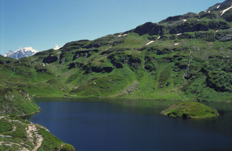
Starting from the parking at Moulins d’en Haut, this 5 km loop wanders through gentle slopes, passes the Chalets du Souay and ends at the tranquil Lac de Pormenaz. With an elevation gain of just 180 m, it is perfect for children and beginners. The path is well‑marked, the trail surface is compacted earth, and there are several points of view where you can snap a photo of the lake framed by the Arête de Pormenaz.
2. The mid‑level trek – a taste of the high mountain
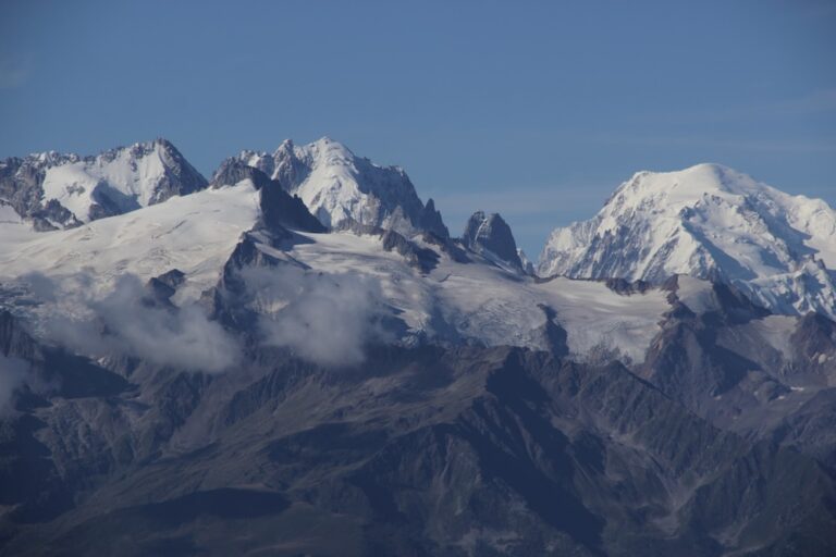
This 10 km itinerary adds the Pointe Noire de Pormenaz and the Chalets de Chavanne‑Neuve. The gradient increases noticeably after the Souay torrent crossing, but the reward is a spectacular panorama over the Mont‑Blanc massif. The total ascent is about 720 m. Hikers should carry a light jacket as weather can shift quickly at the 958 m altitude gain before reaching the summit.
3. The arduous summit push – for experienced hikers
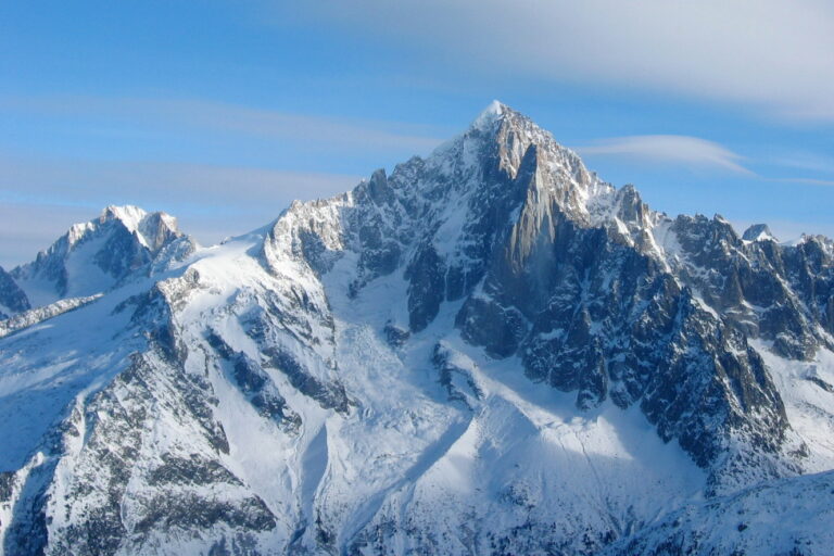
From the Arête de Pormenaz you ascend the final ridge to the true high point of the Tête de Pormenaz. This section is a steep, exposed pente raide of roughly 500 m over 2 km, demanding sure‑footedness and a good sense of balance. It takes about 1 hour 30 minutes from the last refuge (the Refuge de Moëde‑Anterne) and finishes with a 360° view that includes the Gorges de la Diosaz, the Chorde valley and the distant Col du Brévent.
| Route | Distance | Elevation gain | Estimated time |
|---|---|---|---|
| Gentle loop (family) | 5 km | 180 m | 2 h |
| Mid‑level trek | 10 km | 720 m | 4 h |
| Summit push | 2 km | 500 m | 1 h 30 |
All routes are subject to Conditions des sentiers that change with the seasons. In spring, melting snow can make the trail slick; in summer, the high grass can hide the track; in autumn, fog often rolls over the Alpages de Pormenaz and reduces visibility. The Office de Tourisme updates the weather conditions daily, so it is wise to check before setting out.
Beyond the summit – lakes, waterfalls and hidden gems
The region surrounding Tête de Pormenaz is a Réserve naturelle that cradles several water bodies and geological curiosities. The most notable include:
- Lac de Pormenaz – a shallow, turquoise lake framed by alpine meadows; ideal for a quick picnic or a reflective break.
- Lake du Lac Vert – reachable via a short detour from the Route du lac vert, this hidden pool is fed by an underground spring.
- Souay torrent – a lively stream that rushes through a narrow gorge, offering a natural soundtrack for hikers on the mid‑level trek.
- Gorges de la Diosaz – a dramatic canyon carved by the Diosaz river, accessible from a side path near the Parking des Moulins d’en Haut.
Fishing enthusiasts will find the clear waters of the Souay torrent stocked with trout, though a local permit from the high mountain office is required. The Chalets du Souay and the Chalets des Alpages de Pormenaz still house seasonal shepherds who can share stories about the land, making a quick stop a cultural highlight.
Practical information – dates, access conditions and tips
While the mountain is technically open year‑round, the Dates d’ouvertures for the most popular routes are generally from late June to early October, when the snow has melted and the alpine flowers are in full bloom. In winter the summit path becomes a difficile snow‑covered ridge suitable only for experienced mountaineers equipped with crampons.
Key access points and services:
- Parking des Moulins d’en Haut – 150 free spots, with a small fee for electric vehicle charging.
- Tourist office in Servoz – maps, up‑to‑date trail conditions and a hotline for emergency weather alerts.
- Refuge de Moëde‑Anterne – offers simple dormitory accommodation and a hearty mountain soup on demand.
- A limited bus stop service that runs twice daily from the train station in Saint‑Gervais‑les‑Bains.
When planning your visit, keep the following in mind:
- Check the weather conditions early in the morning; storms can develop rapidly at high altitude.
- Carry sufficient water – the alpine streams are swift and not always safe to drink directly.
- Wear sturdy hiking boots with good ankle support, especially for the high gradient sections near the summit.
- Respect the biodiversity of the area: stay on marked trails, do not disturb the delicate flora, and pack out all litter.
Finally, for those who prefer a digital companion, the AllTrails app offers downloadable GPX tracks that work offline, ensuring you never lose the path even when cell service disappears.
Frequent Asked Questions
When is the best time of year to hike Tête de Pormenaz?
The ideal window runs from late June to early October. During this period the snow has retreated, the alpine meadows are vibrant, and the weather is most stable. Early season hikers should be ready for occasional rain showers, while late‑season trekkers may encounter early snow patches on higher sections.
Can I reach the summit without any technical equipment?
Yes, for hikers in good shape the final ridge can be tackled with just sturdy boots and a trekking pole. However, the last 500 m is a steep, exposed pente raide, so a headlamp and a basic first‑aid kit are advisable. If you are uncomfortable with exposed terrain, stick to the mid‑level trek that stops at Pointe Noire de Pormenaz.
Is there a place to stay overnight near the trail?
The nearest shelter is the Refuge de Moëde‑Anterne, located on the flank of the mountain. It offers dormitory‑style rooms and a simple restaurant serving local dishes. For a more rustic experience, the Chalets des Alpages de Pormenaz can be rented for a night during the summer months, but bookings must be made well in advance through the Office de Tourisme.
What wildlife might I encounter on the trail?
While the area is primarily known for its flora, you may spot chamois, marmots, and occasional ibex on the higher pastures. Birdwatchers often enjoy sightings of golden eagles soaring above the Arête de Pormenaz. Remember to keep a respectful distance, especially during the breeding season.
Is fishing allowed in the Souay torrent?
Yes, the clear waters are stocked with trout, but a local fishing permit is required. Permits can be purchased at the tourist office in Servoz and are valid for the entire summer season.
Planning your adventure on Tête de Pormenaz
From the gentle loops that wind through fragrant Alpine meadows to the rugged summit that rewards you with a sweeping view of the Mont‑Blanc range, Tête de Pormenaz offers a spectrum of experiences for every type of outdoor enthusiast. Keep an eye on the Conditions des sentiers, respect the natural environment, and take advantage of the local knowledge available at the Office de Tourisme. Whether you are chasing the perfect photograph of the Lac de Pormenaz or testing your stamina on a high‑gradient ridge, the mountain promises memories that linger long after you descend.
So lace up your boots, pack a lightweight jacket, and set your compass for the ridge – the adventure begins at the foot of Tête de Pormenaz, and the mountain is waiting to share its secrets.