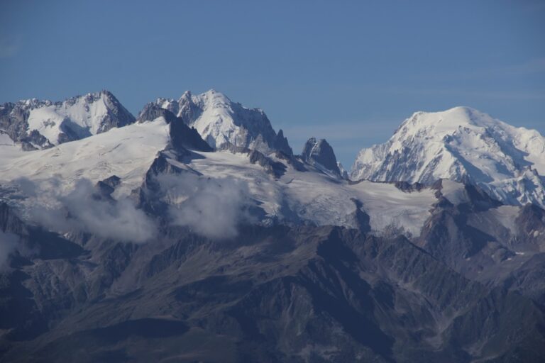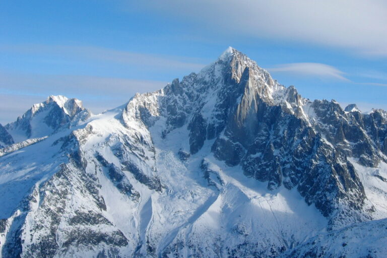
Perched on the Franco‑Swiss border at 2 842 m, Tête de Balme is the kind of summit that lives in postcards but also in the boots of serious hikers. From the Alps to the Mont Blanc Massif, the peak offers a panoramic view that sweeps over France, Switzerland, the glittering Arve river and the snow‑capped Aiguille des Posettes. Whether you’re tracking the circuit Le Tour, counting your elevation gain or simply chasing fresh powder, the trail to Tête de Balme is a micro‑adventure that blends challenge and scenery in equal measure.
What makes the hike truly unique is its setting in the Le Tour valley, a quiet part of the Vallorcine ski area that sees fewer crowds than the bustling Chamonix centre. The route snakes past the historic Col de Balme, drops into alpine meadows dotted with wildflowers, and finishes on a flat grassy top that feels like a natural balcony over the mountain range. Below you’ll find everything you need to plan a safe, enjoyable trek – from weather patterns to trail reports – all wrapped in a tone that feels like a chat over a hot chocolate after a cold day on the slopes.
Table of Contents
Where is Tête de Balme and how to reach the trailhead?
The summit sits at the junction of the Geographic coordinate system coordinates 45°58′12″ N, 6°54′33″ E, straddling the boundary that separates France from Switzerland. The most common approach starts from the small hamlet of L’Arolette in the Le Tour valley, a short bus ride from Chamonix (approximately 15 km). From L’Arolette, the trailhead is clearly marked with a wooden post and a small map showing the key col and the path to the summit.
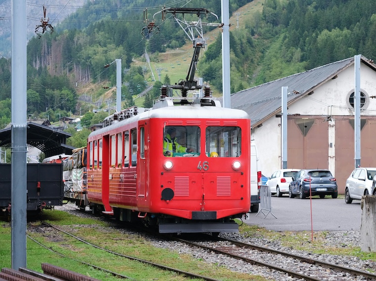
For those preferring public transport, the gondola from Le Tour to Les Grands Autannes cuts off the first kilometre of ascent and drops you at 1 850 m. A short drag lift ride brings you to the Autannes chair, where the forest trail begins.
- Nearest ski lift: Autannes chair (drag lift)
- Closest road: D-1091, which runs parallel to the Arve river
- Parking: Small free lot at L’Arolette (capacity 20 cars)
The route is also the 9th segment of the famous Tour du Mont Blanc, making it a popular detour for thru‑hikers. If you’re on the UTMB® circuit, the segment “Trient – Mont Roc” passes within a few kilometres, offering a chance to combine ultra‑trail mania with a classic Alpine summit.
Trail overview – circuit Le Tour – Tête de Balme – Col de Balme
The loop, often dubbed “the circuit Le Tour – Tête de Balme – Col de Balme”, is a family‑friendly loop that can be completed in 5–5.5 hr at a moderate pace. The total distance is roughly 12 km with an elevation gain of about 900 m, making it a “hard hike” for beginners but a “moderate trail” for seasoned walkers.
| Segment | Distance | Elevation gain |
|---|---|---|
| L’Arolette → Col des Posettes | 3 km | 350 m |
| Col des Posettes → Tête de Balme summit | 4 km | 400 m |
| Summit → Col de Balme | 2 km | 150 m |
| Col de Balme → L’Arolette | 3 km | 0 m |
The first section winds through a forest trail of spruce and larch, offering generous shade in the early morning. As you climb, the tree line gives way to an alpine meadow where alpine flora – edelweiss, gentians and yellow mountain avens – dot the landscape. Mid‑day sees the path open up to a rocky ridge, exposing hikers to strong wind but rewarding them with panoramic views of the Mont Blanc dome and the shimmering glaciers below.
“I reached the summit just as the sun broke through the clouds – the sight of the Aiguille des Posettes bathed in gold was unforgettable.” – a recent hiker on AllTrails.com
What to expect: difficulty, terrain and safety considerations
The trail is classified as a moderate trail with a few sections that become rock free and slightly exposed. While the overall gradient is gentle, the final ascent to the summit involves short stretches of “scrambling” over loose scree; sturdy boots with good ankle support are recommended.
Terrain highlights
- Forest section: well‑maintained wooden boardwalks, occasional boardwalks over wet ground.
- Alpine meadow: flat grassy top, perfect for a picnic and a quick check of the snow report.
- Rocky ridge: a narrow, wind‑exposed strip demanding careful footing.
Safety and avalanche risk
During winter and early spring, the ridge can become avalanche prone. The Live weather and snow report from the local tourist office should be consulted before setting out. The area’s snowpack is typically stable after a cold night, but a sudden rise in temperature can increase the avalanche risk. Always carry a beacon, probe and shovel if you’re planning a winter ascent.
Visibility can drop to visibility from 10 km or less when fog rolls in from the valley. In such conditions, a good map and a GPS device referencing the UTM grid are essential.
Seasonal tips – weather, snow and the best time to hike
The weather in the Alps is notoriously fickle. Summer days (June – September) are usually sunny with temperatures ranging from 10 °C at the summit to 20 °C in the valley. Evening thunderstorms can appear suddenly, so a light rain jacket is advisable.
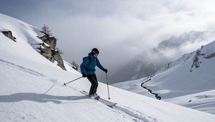
Winter (December – March) offers a pristine snow landscape, with the summit often covered in packed powder or fresh snow. The snow height can exceed 30 cm, making the ridge a favourite for off‑piste skiers and backcountry enthusiasts. The snow report usually indicates a “good” condition in February, but beware of high winds that can create “wind‑packed” crusts.
Spring (April – May) brings mixed conditions – melting snow, muddy trails, and a burst of wildflowers in the meadow. The best time to walk the full loop without snow is late June to early September, when the temperature is moderate and the snow report shows minimal coverage.
A quick glance at the weather forecast for Le Tour shows an average of 5 °C in July and 12 °C in August, with a daily chance of rain around 20 %. This makes late July the ideal window for a clear summit experience.
Flora, fauna and the Alpine atmosphere
The journey from the forest floor to the summit reveals a striking transition of ecosystems. In the lower woods you’ll hear the distant call of the rock ptarmigan and may spot a shy Alpine ibex grazing on the edge of the path. As you cross the scenic saddle near the Col des Posettes, a carpet of alpine meadow blooms with gentians, edelweiss and the occasional orange “poppy of the Alps”.
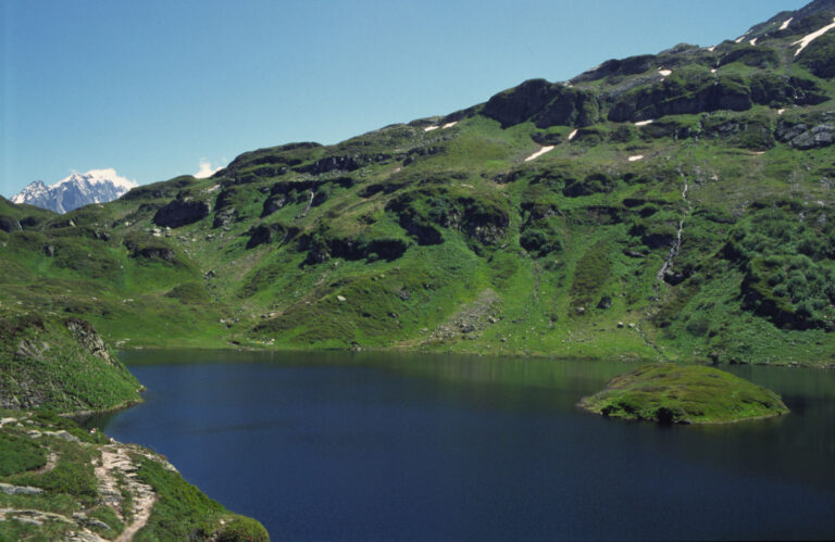
Mid‑summer brings a burst of colour from the wildflowers, while early autumn paints the foliage with golden tones. The meadow’s flat grassy top offers a perfect spot for a break, a quick dip in a free water source, and a chance to soak in the panoramic summit view that stretches from the Mont Blanc dome to the distant Emosson dam across the border.
Practical information – gear, navigation and local services
Below is a concise checklist to keep you on track:
- Gear: waterproof boots, layered clothing, trekking poles, map (or offline GPS), headlamp.
- Navigation: the trail is marked with red and white blazes; a geohack link can provide latitude/longitude (45.9700 N, 6.9092 E) for precise plotting.
- Safety: check the Live weather portal, carry a small first‑aid kit, and respect any “closed” signs during high avalanche risk periods.
- Refreshments: a small café at L’Arolette sells water, tea and a hearty croissant – perfect for the pre‑hike fuel.
- Contact: the tourist office in Le Tour (phone +33 4 50 53 12 34) is open Monday‑Friday 9 am‑5 pm; they can provide up‑to‑date snow report and trail conditions.
If you’re planning a longer trek, consider linking the circuit with the Col de Balme crossing into Switzerland. From there, the Vallorcine ski resort offers a network of blue piste and red piste runs, a magic carpet for beginners, and even a cruisy blues** zone for relaxed descents.
Connecting trails – from Tête de Balme to the wider Mont Blanc network
The Tour du Mont Blanc (TMB) passes a few kilometres south of the summit, allowing hikers to combine the Tête de Balme loop with a segment of the legendary 170 km trek. The most popular link is the “Col de Balme – Aiguille des Posettes” stretch, which adds an extra 3 km of ridge walking and a panoramic viewpoint over the Mont Blanc Massif.
For ultra‑runners, the UTMB® “Segment 5 – Le Tour to Vallorcine” follows a similar corridor but incorporates a fast‑track drag lift and some technical sections on the glacier’s edge. The backcountry area that surrounds Tête de Balme is also a playground for ski‑tourers in spring, with off‑piste routes that lead to the Glacier des Bossons.
Whether you aim to stand on the summit, descend into the ski resort of Le Tour for a day of blue pistes, or continue on the TMB, the flexibility of this region is a major draw for both hikers and mountain‑bikers.
Frequent Asked Questions
What is the hardest stage of the TMB?
The most demanding part of the Tour du Mont Blanc is generally considered to be the Fenêtre d’Arpette pass at 2 665 m on stage 8 (Champex – Col de la Forclaz). The ascent involves a steep climb and variable weather, requiring experience with altitude and exposure.
Where is Balme ski resort?
The Balme / Les Autannes ski area, also known as Vallorcine / Le Tour, lies within the Chamonix‑Mont‑Blanc region of Haute‑Savoie, France. It offers roughly 29 km of slopes, ranging from cruisy blues to intermediate reds, and is served by 13 lifts, including the Autannes chair and a drag lift.
What is the summit altitude of Tête de Balme?
Tête de Balme reaches an official summit altitude of 2 842 m. Its topographic prominence is modest, but the isolation offers spectacular 360° views of the surrounding Alpine peaks.
Is the circuit Le Tour – Tête de Balme – Col de Balme suitable for dogs?
Dogs are permitted on the trail, but keep them on a leash, especially near the exposed ridge and during the high‑traffic summer months. Remember that wildlife, such as ibexes, can be disturbed by off‑leash pets.
When is the best time of year to hike the Tête de Balme loop?
Late June through early September provides the most reliable footing and clear weather. In July, snow has usually melted, the meadow is in full bloom, and the temperatures are comfortable for a full‑day hike.
How busy is the trail during peak season?
While the Chamonix valley can be crowded, the Le Tour side remains relatively tranquil. Expect a moderate flow of hikers on weekends, but weekdays often feel solitary, especially early in the morning.
Are there any facilities for water along the route?
There is a small, free water source near the Col des Posettes, supplied by a natural spring. It’s advisable to bring a water filter or purification tablets, as the flow can be seasonal.
Why Tête de Balme belongs on every Alpine itinerary
From its strategic position on the Franco‑Swiss border to the varied ecosystems you cross on the way, Tête de Balme packs a punch that belies its modest elevation. The trail delivers an accessible moderate hike with moments of technical challenge, a kaleidoscope of wildflower‑filled meadows, and a summit that rewards you with a sweeping panoramic view of the Mont Blanc dome, the Aiguille des Posettes and the distant Emosson dam.
Whether you’re a seasoned mountaineer tracking peaks on peakbagger.com, a casual walker looking for a day in nature, or an adventure‑seeker chasing the next UTMB® segment, this loop offers the perfect blend of accessibility and Alpine grandeur. Pack your boots, check the live weather, and set out for a hike that will stay in your memory long after the snow has melted.