Stretching across the high Alpine spine of the French Alps, the Col de Salenton offers a rare blend of rugged beauty and accessible adventure. Nestled between the iconic Aiguilles rouges and the serene Vallée de Bérard, this mountain pass draws hikers, runners and wildlife lovers from around the globe. Whether you start from Vallorcine, swing by the refuge de la Pierre à Bérard, or simply chase the panoramic view of Mont Buet, the route promises elevation, scenery and a touch of Alpine mystery.
From the early summer thaw to the crisp autumn air, the pass transforms with each season, unveiling waterfalls, rocky terrain, and occasional snowfields. The trailheads are well‑marked with yellow‑red and GRP markers, and the gentle hum of the nearby ski lifts at Passy reminds you that even in the high mountains, civilisation is never far away. Let’s dive into what makes Col de Salenton a must‑see on any Chamonix Vibes itinerary.
Table of Contents
Where is Col de Salenton?
The Col de Salenton sits at an altitude of roughly 2,300 m (7,546 ft) in the Haute‑Savoie department, just a short drive from the bustling town of Chamonix. The most common approach is from the village of La Poya, a charming hamlet that serves as the gateway to the Bérard valley. From there, a well‑maintained path leads through the nature reserve of Passy, hugging the edge of the cascade de Bérard before climbing the scree slope toward the summit. GPS coordinates place the pass at 45.9989° N, 6.9213° E, a handy reference for those using a handheld gpX device.
Geographically, the col links the valleys of Vallorcine and Servoz, making it a strategic crossing point for the historic mountain traders. Today, it fulfils a very different role: a scenic conduit for hikers and trail runners seeking moderate difficulty with rewarding views. The surrounding landscape includes the iconic Aiguilles des Grands Montets, the towering Mont Buet and the gentle slopes of Loriaz, each casting a distinctive silhouette at sunrise.
Hiking & Running Trails to Col de Salenton
Multiple routes converge at the col, each varying in length, elevation gain and difficulty. Below is a quick comparison:
| Trail | Distance | Elevation gain | Difficulty |
|---|---|---|---|
| La Poya – Col de Salenton (via Bérard waterfall) | 8 km | 720 m | moderate difficulty |
| Vallorcine – Col de Salenton (via refuge de la Pierre) | 12 km | 1,050 m | hard hike |
| Servoz Loop (running trail) | 5 km | 450 m | moderate strenuous |
The most popular entry point for runners is the Servoz Loop, a swift 5‑km running trail that weaves through grassy meadows, crosses a small footbridge over a mountain stream, and offers a handful of steep sections that test endurance without being overly technical. For hikers seeking a longer day, the Vallorcine route takes you past the refuge de la Pierre à Bérard, a rustic stone shelter where you can rest, refill water bottles, and perhaps spot an ibex grazing on the rocky outcrops.
All routes are marked with paint marks and the occasional carins stone cairn. In early summer, expect to navigate through wildflowers and occasional patches of granite slabs that require careful footing. Late autumn brings a dusting of snow; a very difficult route then transforms into a snowfield trek requiring crampons and a solid sense of balance.
What to pack for a day on the col
- Sturdy hiking boots with good ankle support
- Layered clothing – a waterproof shell, fleece, and a warm hat
- At least 2 L of water; the spring near the cascade is potable
- Map or offline GPS (the trail is well‑marked, but fog can roll in quickly)
- Snacks and energy bars – the altitude can sap energy fast
Points of Interest near Col de Salenton
While the col itself is a panoramic view point, the surrounding area is dotted with attractions that enrich any itinerary. Just a short detour leads to:
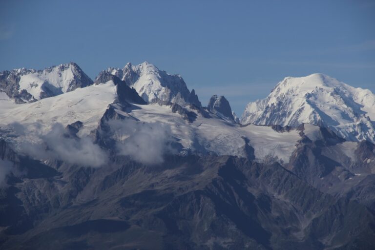
- Mont Buet – the “Swiss Matterhorn”; its summit can be seen on clear days.
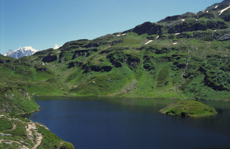
- Valley of Bérard (Vallée de Bérard) – a lush, river‑carved canyon perfect for photography.
- Passy Nature Reserve – home to rare alpine wildlife such as the ibex and golden eagles.
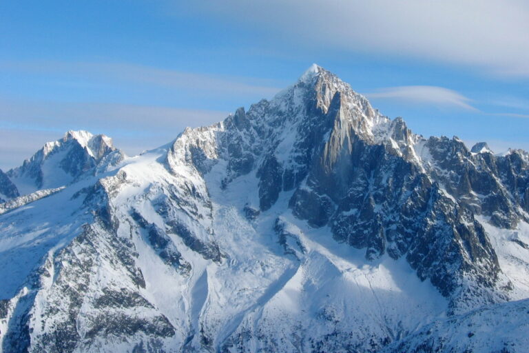
- Aiguilles rouges – striking red‑hued peaks that dominate the skyline.
- The historic refuge de la Pierre à Bérard – a place to rest, sip tea, and exchange stories.
One of my favourite moments was watching a lone ibex navigate a boulder field near the footbridge behind the cascade. The sight, framed by the towering cliffs, felt like a live postcard. Families with children often linger at the lower meadow where deer grazing is common, while dogs on leashes can romp in the open grass without disturbing the wildlife.
Col de Salenton Photos and Visual Highlights
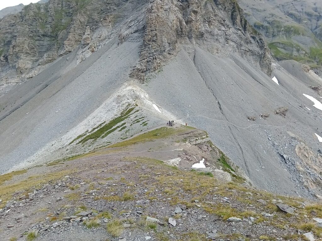
Photography enthusiasts will find endless subjects: from the reflective pools at the base of the cascade de Bérard to the dramatic silhouettes of the Aiguilles rouges at sunset. Below is a small gallery of images captured by local hikers:
- Morning mist lifting off the rocky terrain – a dreamy blue‑grey canvas.
- Sun‑kissed granite slabs near the summit, ideal for dramatic close‑ups.
- Wildflowers in full bloom in early July, painting the meadow in purple and yellow.
- Panoramic view of Mont Buet from the col, with clouds drifting lazily across its summit.
If you’re planning a trip in winter, be ready for a glittering blanket of snow that transforms the path into a quiet, white‑washed wonderland. Early morning light on the snowfield yields incredible contrast for monochrome photography, while a gentle rain in autumn creates misty veils that enhance the sense of mystery.
Trail Resources and Practical Tips
To make the most of your adventure, consider the following resources:
- PDF maps available for download at the Chamonix Vibes visitor centre.
- Offline gpX tracks that work without mobile signal – essential for the high‑altitude sections.
- Local trailhead signs provide real‑time information about weather and trail condition.
Weather in the Alps can shift dramatically. Summer days are generally sunny with occasional rain, while early autumn brings cooler temperatures and occasional wind gusts that can be felt on the exposed ridges. In winter, snow and ice dominate; the route then becomes a very difficult alpine trek that should only be attempted by experienced mountaineers equipped with crampons and an ice axe.
For those interested in longer treks, the Tour du Mont‑Blanc (TMB) passes close to the col, offering an opportunity to combine the Salenton experience with a segment of the renowned 170‑km loop. The tour des fiz is another lesser‑known circuit that skirts the southern slopes of the Aiguilles rouges, providing a quieter alternative to the crowded main trails.
Reviews and Ratings from Hikers
Feedback from the community paints a vivid picture of the col’s appeal. On a scale of 1 to 5, most hikers award the route a solid 4.5, citing the “unspoiled scenery” and “well‑maintained markers” as highlights. A recurring theme in the comments is the friendliness of the refuge staff, who often share local lore about the area’s mining past.
“The Col de Salenton was a highlight of my Alpine trip. The walk was challenging enough to feel rewarding, but the view of Mont Buet made every breathless step worth it.” – backpacker from the UK
Some users note that, in late September, the path can become slippery due to lingering rain, so they recommend sturdy boots with good grip. Families with small children appreciate the relatively short moderate difficulty segment from La Poya, which lets them experience high‑altitude terrain without the strain of a long ascent.
Frequent Asked Questions
How long does it take to reach the col from the nearest trailhead?
The typical ascent from La Poya to the summit takes between 2.5 and 3 hours for an average hiker, covering roughly 8 km with an elevation gain of 720 m. Faster runners can complete the same distance in about 1.5 hours, while those stopping for photos or breaks may need up to 4 hours.
Is the trail suitable for dogs?
Yes, dogs on a leash are welcome on most sections. The lower meadow near the cascade is especially dog‑friendly, offering shade and a stream for a quick drink. However, the upper scree slopes become steep and rocky, so a well‑trained dog is recommended.
What wildlife might I encounter?
Besides the iconic ibex, you may spot chamois, marmots, and a range of alpine bird species such as the golden eagle and alpine chough. During the summer months, colourful wildflowers carpet the meadow, attracting pollinators and adding bursts of colour to the scenery.
Can I camp or bivouac near the col?
Designated bivouac zones exist on the western side of the col, marked by discreet stone piles. While wild camping is generally tolerated, it is advisable to respect the environment, keep fire ban in mind, and leave no trace. The nearest official campsite is the refuge de la Pierre à Bérard, which also offers basic shelter.
What is the best season for photography?
Late June to early August gives you vibrant wildflowers and long daylight hours, perfect for wide‑angle shots of the valley. Early autumn (late September) provides golden light and fewer crowds, while the winter months deliver dramatic snow‑covered landscapes for black‑and‑white compositions.
What awaits you at Col de Salenton
From the moment you set foot on the marked path, the mountain pass invites you into a world where geology, flora and alpine heritage converge. Whether you’re a seasoned hiker chasing the next summit, a family looking for a moderate day out, or a photographer hunting that perfect light, Col de Salenton delivers.
Remember to check the weather forecast, pack wisely, and respect the fragile mountain environment. With each step you’ll discover why this humble col holds a special place in the heart of the Chamonix valley – a place where every panoramic view feels like a secret shared only with those who venture up the trail.